There have always been certain locations that have appeared in all my projects; one of them is the city of Toronto. But that’s the weird part about running a project that relies on some freedom of movement when that freedom has been curtailed. You often have to find new locations to visit. But it took twenty-nine weeks to make it out into Toronto. But it was a weird way of going into the city. I didn’t take public transit, I went early, and I drove in, right into the core of Toronto. Something I don’t often do, because well, I don’t particularly appreciate driving in Toronto. It’s not my favourite thing. But I don’t want to take public transit at the moment. So here we are.

Nikon FM – AI-S Nikkor 35mm 1:2.8 (Yellow-12) – Fomapan 100 @ ASA-100 – Adox Rodinal (1+50) 9:00 @ 20C
Some 12,500 years ago, the area we know today as the city of Toronto was covered under a massive ice shelf; as it slowly retreated along with other glaciers, Ontario was formed, including the Great Lakes. Lake Iroquois covered much of the modern downtown of Toronto, up to the end of Spadina Avenue at its northern point. The first humans started arriving in the area some 7,000 years ago; these first peoples followed rivers, lakes, and overland passages that connected Georgian Bay to modern Lake Ontario. The name given to this passage in the Mohawk Language is tkoronto or translated where trees stand in water. The passage became an important part of these indigenous peoples, and by 500CE, some of the first human settlements started appearing. The Anishnabeg constructed small settlements living in the region mainly during the warmer summer months. By 1000CE, the Huron-Wendat began to establish larger walled communities in the region. Six hundred years later, the first Europeans arrived, French fur traders who saw the Toronto Passage as an excellent means to head further north. But they also brought new deadly illnesses and warfare. The Beaver Wars of the mid-1600s saw the Haudenosaunee push north, killing or chasing off the Huron-Wendat people. They would establish two known villages in the area, but by the 1700s, the Anishinabe or Mississaugas had pushed the Haudenosaunee. The French realising the importance of the area established their first fort in 1720. It lasted a decade before being abandoned. A second post, Fort Rouillé, arrived in 1750. During the final days of the French & Indian War, the French abandoned Fort Rouillé, burning it to the ground in 1759.

Nikon FM – AI-S Nikkor 35mm 1:2.8 (Yellow-12) – Fomapan 100 @ ASA-100 – Adox Rodinal (1+50) 9:00 @ 20C
While the British maintained a small trading relationship with the Mississaugas, they made no major colonial inroads in the region until the American Revolution. Loyalists began flooding north, fleeing from the persecution of their continued loyalty to the British Crown or by choice. Sir John Graves Simcoe, noting that the current capital of Upper Canada at Niagara-On-The-Lake was close to the American border had a new townsite laid out in 1793, seeing the Toronto Passage and a harbour along with a central location in the newly formed province as a solid strategic choice. Simcoe and other colonial authorities had made a dubious treaty with the Mississaugas for this land in 1787 mainly because of the vague indications on the bounds of that purchase. But Simcoe had no problems and began to layout a small townsite, setting aside a large tract for a garrison, establishing a grid street pattern and building a parliament for governing the province. He gave the town the name of York after the Duke of York, the son of King George III and sent members of the Queen’s Rangers north, east, and west, cutting new roads to expand the colonial reach. The Toronto Passage would become what we know as Yonge Street today. By 1805 the matter of the Toronto Purchase was settled under Treaty 13 with the Mississaugas. Despite being the capital of Upper Canada, York remained a rough backwater community in greater British North America. The unpaved streets earned it the nickname Muddy York. By 1812 the town had a population of 700 and faced attack twice by American forces in 1813, during the first assault American troops and local prisoners went on a spree of looting and burning. But the town rebuilt, and a third assault was turned back. Through the 1820s and 1830s, waves of immigration swelled the town. It quickly became the economic centre of Upper Canada, and a political powerhouse as a group of men known as the Family Compact could control almost every aspect of the province often for their own gain.

Nikon FM – AI-S Nikkor 35mm 1:2.8 (Yellow-12) – Fomapan 100 @ ASA-100 – Adox Rodinal (1+50) 9:00 @ 20C
By 1834 the town of York incorporated as the City of Toronto and one William Lyon MacKenzie elected the first mayor. MacKenzie was not the best man for the job, often using the power of the office for his own gain; ironically, he spoke out about such abuses of power by the Family Compact. And by 1837, he had whipped up revolution fervour and attempted a violent overthrow and establishment of a Republic in the failed Battle of Montgomery’s Tavern and Upper Canada Rebellions. The 1840s saw Toronto shed its colonial mud, installing gas lights, paving streets and installing sanitation systems; it became a major hub for all the colonial railways in the 1850s, with all three major first railways and several smaller operators establishing their own stations at the heart of the historic city. Toronto continued to establish itself as a major industrial and commercial centre through the later half of the 19th Century. And was named the capital of Ontario in 1867 at Canadian Confederation. Further industrial growth came in the early 20th Century with northern expansion and the cheap and readily available hydroelectric power coming out of Niagara Falls. Toronto quickly became Canada’s second national metropolis, second only to Montreal. The city’s manufacturing core became a key part of Canada’s war effort in both the First and Second World Wars. During the middle of the 20th Century, Toronto established its first Subway system to aid in taking pressure off the extensive streetcar network and hit a population of 1,000,000 people. The Metropolitan Toronto Committee under Fredrick Gardener would begin in 1953 to further improve Toronto’s transit, parks and road systems, new limited-access expressways planned out and built along, smaller communities were brought into the metropolitan Toronto core by 1967 along with the five outlying boroughs each of which was cities in their own right (save East York) by 1991. In 1998 these were all amalgamated into a single municipal government, as the City of Toronto.

Nikon FM – AI-S Nikkor 35mm 1:2.8 (Yellow-12) – Fomapan 100 @ ASA-100 – Adox Rodinal (1+50) 9:00 @ 20C
Nikon FM – AI-S Nikkor 35mm 1:2.8 (Yellow-12) – Fomapan 100 @ ASA-100 – Adox Rodinal (1+50) 9:00 @ 20C
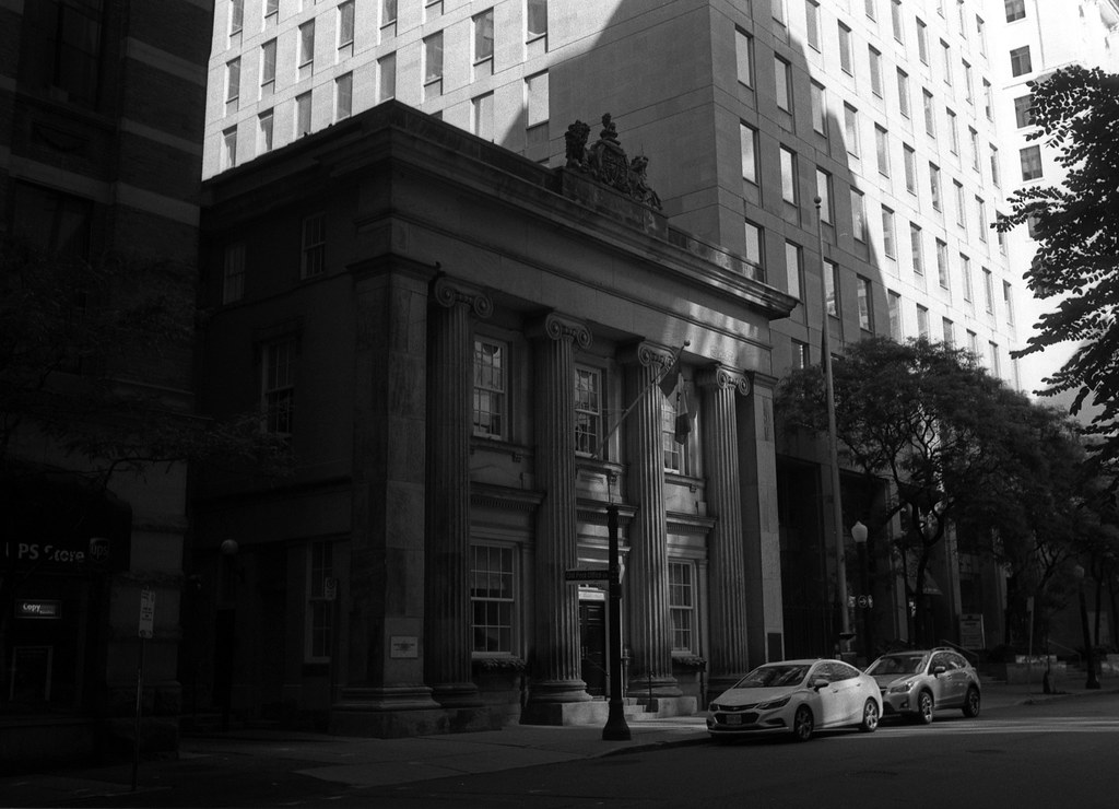
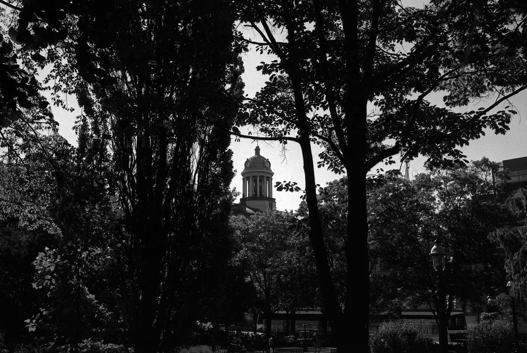
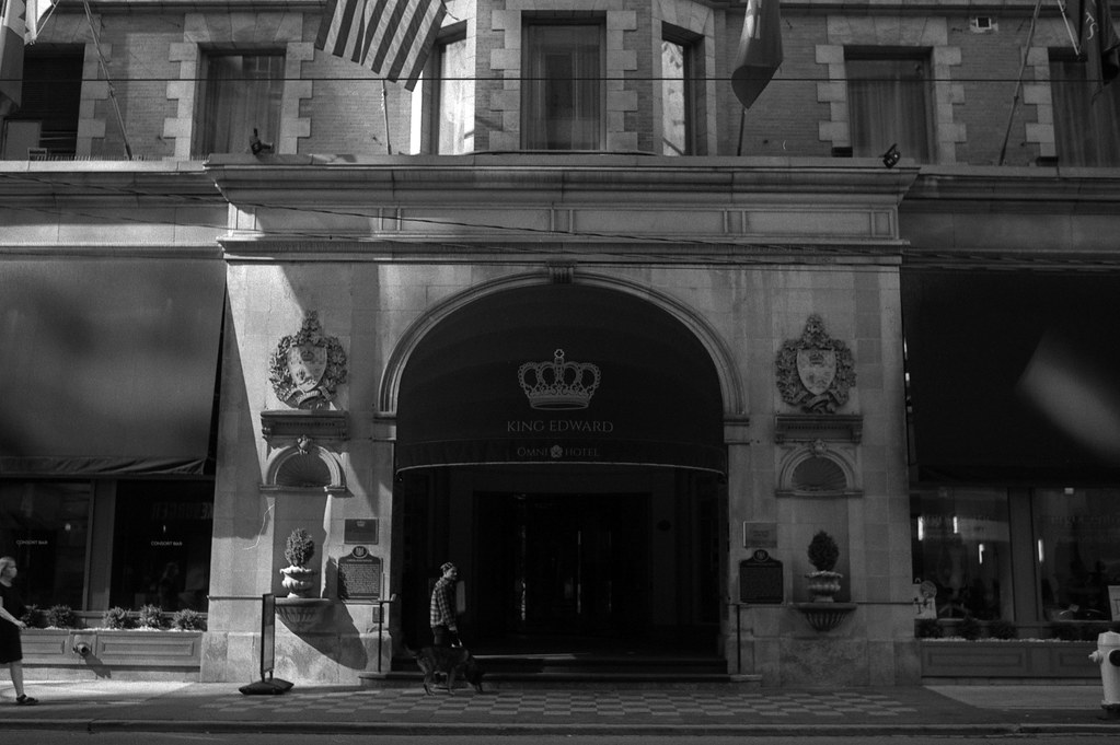
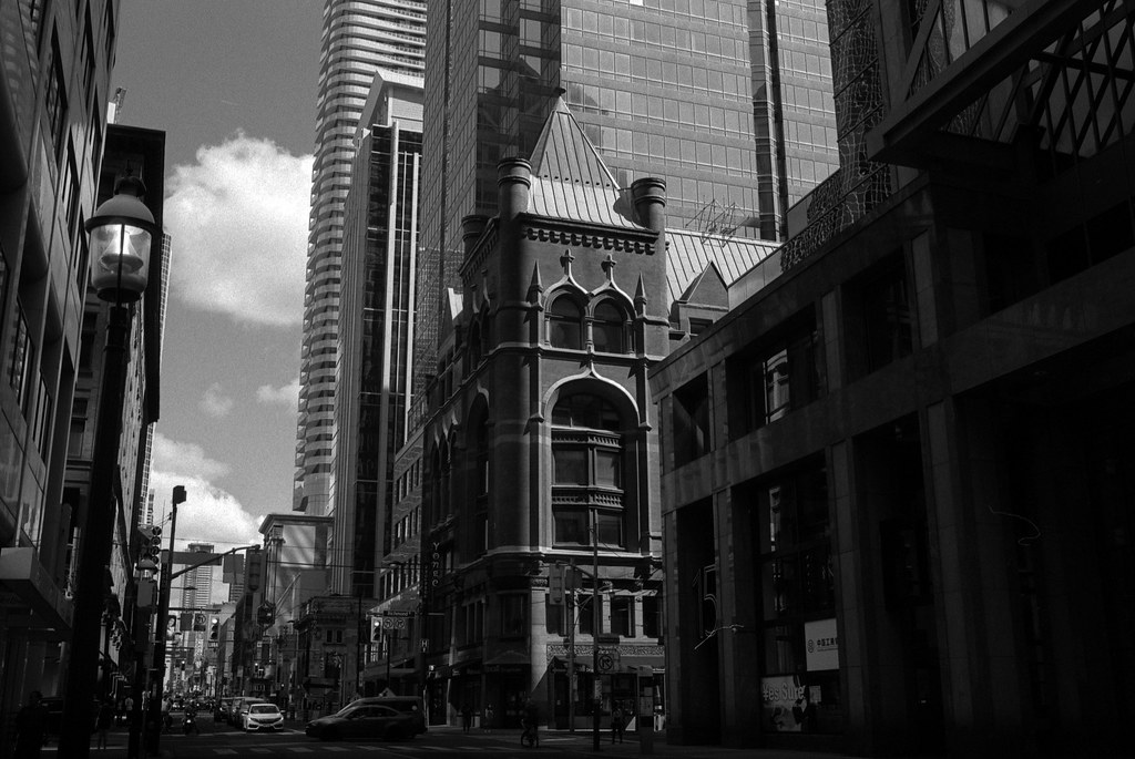
Like Hamilton, Toronto has enough areas and neighbourhoods to reuse the city again for future weeks. Because I had parked down by Roundhouse Park, I ended up sticking to the old Toronto area, the core of the historic city, going no further north than Queen Street for my photos. However, Toronto is a city that has changed so much since its founding at the tail end of the 18th Century and most of the buildings in this area date to the late 19th and early 20th Centuries. But given that I had some longer text blocks in this post, I allowed myself to pick a could extra images to include to break up the history. So with two extra images to play with, I still found it difficult to pick images, so I ended up ensuring that each image including was a historic structure in the city that survive and date back to the 19th Century and found some level of adaptive reuse and survived the gritty decades of the 20th Century that saw extensive urban renewal through demolition but plenty of renewal through restoration. Buildings like the Gooderham Building, The Toronto Street Post Office, York County Courts. Plus reminders of the city’s history with the plaque dedicated to Rebel leaders Samuel Lount and Peter Matthews. The one building I did miss and wish I had remembered at the time is the city’s first post office, but I didn’t recall it until I was partly home and stuck in traffic on the Don Valley Parkway.

Nikon FM – AI-S Nikkor 35mm 1:2.8 (Yellow-12) – Fomapan 100 @ ASA-100 – Adox Rodinal (1+50) 9:00 @ 20C
Nikon FM – AI-S Nikkor 35mm 1:2.8 (Yellow-12) – Fomapan 100 @ ASA-100 – Adox Rodinal (1+50) 9:00 @ 20C
I decided to keep it simple; I stuck with tried and true means and equipment this week. I probably should have used my 28mm lens, but having used it for the past couple of weeks, I went with my trusty Nikkor 35mm f/2.8 lens with a yellow-12 filter as the day again was clear and bright. I didn’t want anything deep as I had to balance between that filter and have mixed lighting as I went into the streets with the tall buildings of the core. Which certainly helped to play with light and shadow with some interesting contrast throughout all the images. I shot the film at the box speed of ASA-100, and development went with a trusty Adox Rodinal at 1+50 I wanted to bump up that contrast and grain to give a far more gritty appearance.

Nikon FM – AI-S Nikkor 35mm 1:2.8 (Yellow-12) – Fomapan 100 @ ASA-100 – Adox Rodinal (1+50) 9:00 @ 20C
Nikon FM – AI-S Nikkor 35mm 1:2.8 (Yellow-12) – Fomapan 100 @ ASA-100 – Adox Rodinal (1+50) 9:00 @ 20C
We’re heading north to the last bastion of civilization before the wild north of Cottage Country.